Tuesday, December 30, 2014

Hikes Around the Seattle Area----December 2014

We left the warmth of Loreto only to encounter a very cold snap in the Seattle area just before Thanksgiving. For Thanksgiving our daughter, Jessica, her husband, Joshua and, their six month old baby boy, Atticus treated us to a fabulous gourmet feast----duck pate, duck salad with a pomegranate sauce, duck brioche pudding topped with seared foie gras, sliced duck with a braised skin, scalloped potatoes, pasta with braised Brussels.


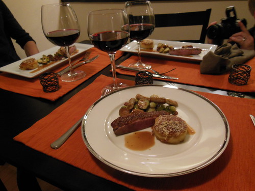
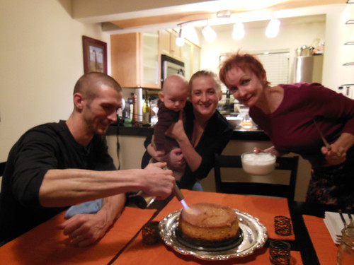
Joshua is plating our Thanksgiving feast----he is a chef after all----for a beautiful presentation.


Joshua is torching the top of Tani's pumpkin-ginger cheesecake---yummy


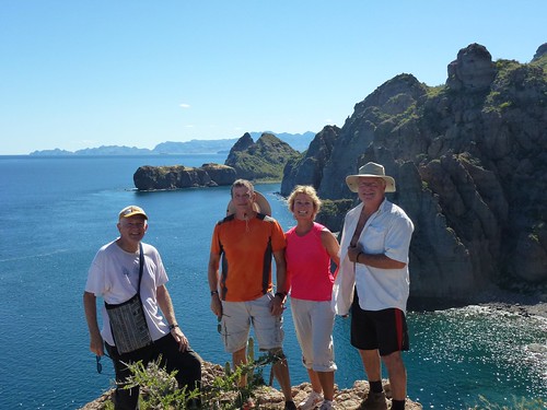
While we were savoring our Thanksgiving together, Jessica suggested that we go for some hikes in the area like we did before.

On December 3rd we met up and decided to hike the Cougar Mountain Park area near where we use to live. We have hiked all of the trails so we picked our favorite one which ended up being about 6 miles. From the Red Town parking lot, we hiked to join the Wildside Trail which led us to the Shy Bear Trail which has a very long puncheon across a big swampy area. After that, we headed down to the Coal Creek Falls.


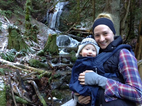
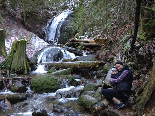
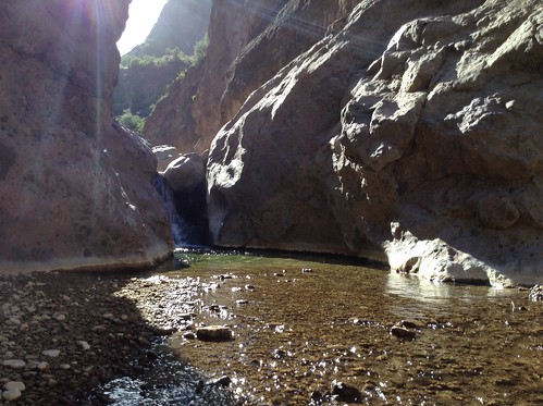
The falls were flowing pretty well and there were lots of icicles forming along Coal Creek. Atticus liked to hold them for a little bit before giving us a surprised look from the cold. He also enjoyed looking around, especially the swaying trees above him as we headed back to Red Town. In the late 1800s, there were about 2000 coal miners and their families living in this area and now the forest has taken over. Scattered holly trees mark where people use to live.

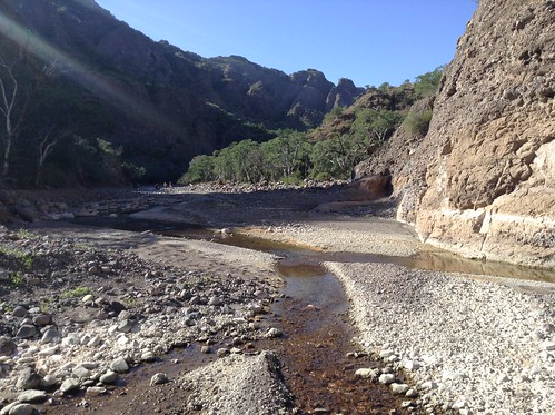
On the way back we detoured through this coal seam path that had a sprinkling of snow and many downed trees from a recent big wind storm.


We enjoy stopping for lunch after our hikes and our usual "go-to" place is either "The Commons" in Woodinville or the Thai Hanaman Restaurant in Kirkland.

The following week we added Leeloo, their long-haired whippet, to our entourage now that Jessica got a screen for keeping the dog contained in the rear of the car. Lots of logistics when moving babies and dogs around. This time we headed to scale Little Mt. Si, which is just outside North Bend. With several cars in the parking lot, we knew that we would encounter other hikers along the way so we needed to leash Leeloo.


The trail is well maintained, steep at the beginning and top, but pleasantly level midway where we crossed a small stream that fits into a culvert that some trail crew made for us. I checked it out carefully and compared it to the one I worked on with the Washington Trails Association at Deep Lake on the Pacific Crest Trail in 2013. This culvert work probably took three or four people about a week to do using hand tools. If you just use the trails, most people have no idea how much work it is to maintain such a trail. It requires cutting back the undergrowth, eliminating erosion from the weather and foot traffic, waste removal, and removing fallen trees.


It was a very windy day to be hiking there and we only realized it as we approached the summit. The winds were gusting up to 50 mph so we had trouble standing still. Even bracing ourselves for pictures we still got buffeted about.
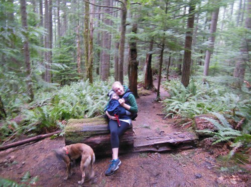
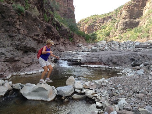
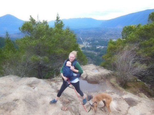
Here Jessica is bracing herself as her hair flies about and we have a view of North Bend below us. By now Leeloo is tiring out and when we take her off-leash, she now stays right by Jessica instead of charging about.


I am trying to stand still, but the wind gusts are pushing me every which way. Time to get off the mountain and back to the safety of "The Commons".

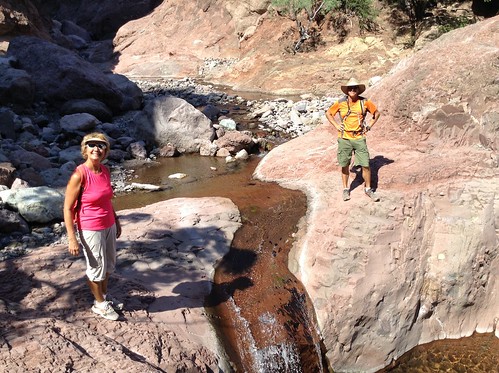
On December 16th, we again headed back to our favorite hiking spot, Coal Creek Falls in the Cougar Mountain Park. Shortly after we headed up the hill to Coal Creek Falls we were alone so we unleashed Leeloo and this was the result:


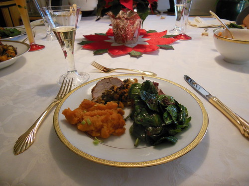
For our Christmas Feast, Tani scoured the internet for the recipes she wanted to put together this feast. The appetizers were marinated scallops wrapped in bacon, followed by cauliflower-leek soup. The main course was wild rice-apple-cranberry stuffed pork tenderloin along with mashed sweet potatoes and wilted spinach with pomegranate dressing. Her desert was her old favorite----cranberry-current pie----with an almond flour crust


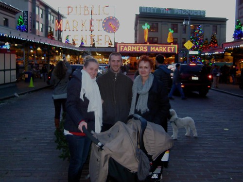
After this feast, we headed up to the Pike Place Market just as the sun was setting so we were able to get the typical tourist shot.


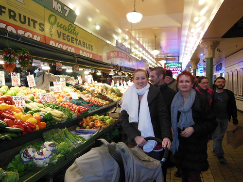
We then "hiked" a bit further to the colorful produce market area.


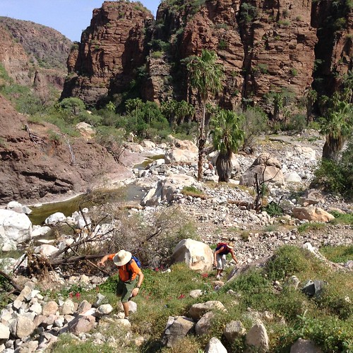
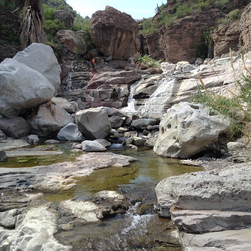
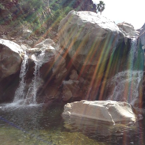
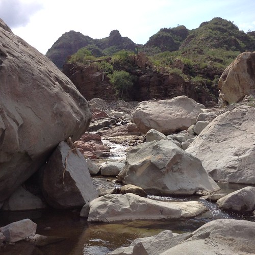
Since Christmas, we have repeated some of the hikes in the Cougar Mtn area, but with a little guy, you always have to be flexible.

Tomorrow I begin my two month trip to SE Asia which includes my first visit to the Philippines along with Thailand as the gateway for my 80,000 United Air miles round trip. Check out my future posts. Again, I am traveling both light and cheap. My new pack and contents now weigh in at just over 7 lbs so traveling will be a breeze.

Thursday, November 20, 2014

Hikes Around Loreto, BCS, MX ---November 2014

I was recently made aware that to access the hikes I have shown on my blog and described in the Hiking Loreto guide book, requires permission from the ranch owners of the land.  


You can contact the president of Loreto Guide Association, Rodolfo Palacios Castro, for a guide to take you on these hikes because they have permission from the owners and are aware of the need to protect these fragile places.  His Facebook site is:  


Currently, the owner of the Las Parras Ranch along the road to San Javier Church sells passes to their property at the Pescador Grocery Store or Hacienda Suites.  As time goes by, there may be more owners who do this.


For the past few years, a group of us from the Loreto Bay area have been exploring some of the hiking areas. We first hiked with Señor Ken---A Canadian hiker--who organized a number of interesting hikes. On one we were joined by DeeDee and Dave Kelly who wrote "Hiking Loreto". After Señor Ken migrated to the La Paz area to hike there, a group of us in Loreto Bay continued hiking using the "Hiking Loreto" guide book.

The hikes described below continue that activity. Gary and Heidi, who did the 5-day Kayak Tour with me, were on all of these hikes, plus they did a few more on their own.
The biggest difference this year is that we have lots of water in the arroyo hikes. With warm weather in November, we also have set up a tradition of swimming somewhere during our hikes. Very refreshing!

TABOR CANYON
Our first day hike was to Tabor Canyon which was always unpredictable on what we would find following the hurricane seasons. We were not disappointed this time.

After meandering up the boulder-filled arroyo, we finally came to some water that trickled over a few rocks and disappeared into the river bed. A few hundred feet more and we began to come to lots of pools of water and soon we could no longer just jump across the widening river.


Our hike soon became a scramble as we went from one side of the canyon to find places we could safely scale without the danger of falling.


Heidi, Natalie, and Joseph are scrambling along the steep canyon walls just before the last waterfall we come to before turning around.


Finally, we could go no further since the wall we had to scale was steep, crumbly with a great exposure to damage of life or limb right where we came to the tallest waterfall.


Here is where we started our tradition of going swimming on all of our hikes. Very refreshing with a back massage thrown in.

After most hikes, we pause for food and refreshments at the Clam Shack, Sabor!, or Del Boracho's. Here at the Clam Shack are Heidi, Gary, Joseph, Natalie, Jeff, me, Greta, and John's clams. A great way to end an enjoyable and challenging hike up Tabor Canyon.


PINTURAS ARROYO
This hike begins about 14 km up the San Javier Road where it crosses a second Vado---a dip in the road where the water can flow over without causing damage. Before Hurricane Ivo buried the cave paintings under tons of gravel, we could view them. The river was running hub deep here as we parked the car and began hiking. After much boulder hopping, we came to some remnants of the old road, but it quickly disappeared in a jumble of boulders.


Heidi is leading us in some of the boulder hopping from one side of the river to the other.
We ended up doing a bit of bushwhacking trying to find the old road without success so we returned to the river and continued boulder hopping.


You can barely see Gary in his orange shirt near the top of this cascading waterfall.


Once again we got to the end of the "easy" trail so we found a nearby swimming spot. where there were two waterfalls. entering a pool.


Boulders after boulders made this a challenging hike.


A lot of coral vines were blossoming along the way drawing the attention of us and clusters of yellow butterflies.

This was one of our most enjoyable hikes. You can keep going up the canyon until you reached Parras. Once there, the Parras ranch charges 50 pesos to walk through their orchards. They gave us lots of oranges, grapefruits, and limes when we walked through here last year. At that time, our group ended up hitch-hiking for a quick way back to our parked cars.

PREMIER AGUA---SLOT CANYON
For this hiking area, the Oasis Premier Agua offers two directions for hikes--north toward the mountains or south toward the Sea of Cortez. We chose south to Slot Canyon which was a loop trail returning us back to our parked car, about a 3-mile hike. The "Hiking Loreto" book calls this easy, but I would term it moderate because of the waterfall climb using a fixed rope to scale the 10-foot waterfall or dry fall in drier times.


Gary and I are standing at the remains of the Loreto swimming pool that has been destroyed by several hurricanes while Heidi takes our picture and the ones of me at the waterfall. The nearby bathhouse has lost its roof and is also deteriorating.

On the way to Slot Canyon, we crossed the river several times on our mile walk downriver. Compared to last year when Slot Canyon was dry, we immediately found ourselves wading through the water through this narrow and beautiful passage until we came to the waterfall with it's challenging rope climb.


I was the first to successfully scale this climb up the waterfall, getting very wet in the process.


Sweet, wet success!


Looking down the waterfall.


JUNCALITO CANYON
It took us a bit of time to find the start of this hike, about .6 miles past the Juncalito road and just south of the electrical pylon by the wooden sign at the wired gate. We headed up the overgrown road until it drifted off to the dry Junacalito arroyo. Check out my weed-covered hiking shoes that look like I am wearing a pair of hedgehogs.


Gary, John, Harv, and Heidi are picking their way through the boulders and river.


Once again, we reach a steep section of the canyon where we decide to turn back.


On many of our hikes, we come across these clusters of yellow butterflies.


Villa Del Palmar Hiking Trails


The resort has built several hiking trails---no boulder hopping here. There are well-marked maps at every trail junction. Each of them is about 45 minutes at a low pace.

To use these trails, you need to go to the front desk for a black bracelet that shows you are not a "real" guest since it is an "all-inclusive" resort. You can have meals here, but can only pay for them with credit cards. The trail begins on the east side of the beach. We headed up to the viewpoint, then hiked down to the beach for a swim, and finally up to the "Osprey Hike.


Heidi and the group are posing at the Blue Whale viewpoint.


Me, Gary, Heidi, and Harv are posing at the Osprey viewpoint. We decided to return via the 18th hole construction area so we could get to Clam Shack for some delicious clams, beverages, and fish.

LIGUI CANYON
Instead of driving into the Villa del Palmar resort, we drove on the gravel road under the Highway 1 bridge. The "Hiking Loreto" guide indicated that you could drive up this arroyo for about 3.5 miles to a parking area. After 2 miles we could drive no further because the recent hurricanes had wiped out the road.


After a bit of hiking, we paused for a photo of our intrepid hikers: Tani, Heidi, Bill, Gary, Steve, and Jeff.

We began walking up the dry arroyo and occasionally saw tire tracks---rugged 4 WD car most likely--- and after about 1.5 miles the river occasionally began to surface. After another mile and a steady flow of the river, we finally came to the Ligui Canyon entrance filled with water.


To continue up this canyon, I had to wade through some of the areas on the way up to where we had to turn around because of the waterfall and steep canyon walls.


In the picture below, I am looking down the canyon from this waterfall area.


Heidi is making her way up to the waterfall where we find a great, but cool swimming hole.

After the swim, we then had to hike back down to our two 4 WDs and return to Loreto Bay.
There are still quite a few more hikes described in the "Hiking Loreto" guide book, but Tani and I will soon be leaving to return to Seattle for our first Thanksgiving and Christmas with our grandson, Atticus, along with his parents, Jessica--daughter--, and Joshua--son-in-law.

Here is a picture of Jessica with Atticus on their recent hike up Rattlesnake Ridge near North Bend, WA. It looks like he may enjoy hiking as much as his Mom and Granddad.

Friday, October 24, 2014

Loreto Kayak Tour---October 20-24, 2014

After arriving in Loreto, BCS, MX, I signed up for a 5 day/4 night kayak tour around the Sea of Cortez. We would go around Danzante Island and spend two nights there and another two nights on Carmen Island. Our tour guide with Paddling South, Loreto Kayak Tours was Antonio Hernandez, Jr who was also a partner in the company. It turned out that I knew his father for several years as the manager of the Loreto Storage Company where I store my car when I am not in Loreto.
The night before our tour, we met at the Oasis Hotel. Although they could accommodate 7 tourists, only three had signed up for this trip. The other two were Gary and Heidi who I knew as my neighbors in Loreto Bay where I live in the winter time when I am not traveling elsewhere.
We carried our food and even a porta-pottie since you cannot bury your waste within the Marine Reserve.
All of the video and most of the photos were taken with my mini iPad and edited with iMovie.

We snorkeled at all of our lunch stops and campsites until our fingers looked like prunes. The water was clear and the fish and sea stars were colorful.

After setting up our Danzante Island campsite we paddled over to Honeymoon Cove and hiked up to the viewpoint.


Every evening was a different Mexican dinner ranging from tostados, tamales, chicken mole with rice, tacos, to fried chicken and refried beans. Breakfasts were equally tasty with tortillas filled with eggs and chiles, or refried beans with shredded chicken to granola, yogurt with papaya.

On the second day we repacked our kayaks and paddled over to Carmen Island for two days.

Not only did we see this pod of dolphins right in front of us, but we also saw a big fin whale, second in size to blue whales that roam the Sea of Cortez.

The light colored gash you see on the far right of the Baja is the newly finished Mirador which use to be the site of frequent rock slides hazardous to passing motorists. It's still a great viewpoint.

Puntas Cavas...another great snorkeling area.


Posing at window rock formation.
Another fabulous meal—This time chicken and vegetable tamales and box of red wine while relaxing in my driftwood chair.

Heidi finds another type of chair. In this marine reserve, all waste must be carried out—no cat holes allowed and we have to pee at the water line and not on land.

After two nights, we left our Carmen Island campsite, and paddled around Danzante Island to our first campsite.
We met up again with the kayak guide training group near this slot in the rocks on Danzante Island.
We stopped for lunch at the next secluded beach where we snorkeled for a couple of hours before paddling around the south end of the Island.

At the south end we could see the large destination resort of Villa del Palmar in the distance which is about 30 miles from Loreto.

We came to the trail on Danzante Island, but decided not to hike. The trail was so overgrown from all of the tropical storms and hurricanes. Also, the large group of kayak tour guides was already ashore.
Antonio prepared chicken mole with rice for our last feast before returning to Loreto.

We were greeted by a beautiful sunrise as we prepared for our return and final breakfast.

We paddled into Escondido harbor which was well protected from the Hurricanes. However, upon entering we saw a few boats which had sustained severe damage. One sailboat had both masts broken off and laying on the deck. Tarps covered damaged living quarters and another boad had been tossed ashore when its anchor gave way. At least 5 boats sunk during this last hurricane Odile.

As we pulled ashore and began loading our stuff into the waiting van, a pod of dolphins passed by bidding us farewell.
Antonio treated us to a celebratory meals lunch and dinner at Sabor! Restaurant where his wife, Miriam joined us. We feasted on the stunning view of the Sea of Cortez and reminisced about our fabulous travels as the sun set behind the Gigantes mountains.
Back home to enjoy another fabulous sunset.