I was recently made aware that to access the hikes I have shown on my blog and described in the “Hiking Loreto” guide book, requires permission from the ranch owners of the land.
You can contact the president of Loreto Guide Association, Rodolfo Palacios Castro, for a guide to take you on these hikes because they have permission from the owners and are aware of the need to protect these fragile places. His Facebook site is:
Currently, the owner of the Las Parras Ranch along the road to San Javier Church sells passes to their property at the Pescador Grocery Store or Hacienda Suites. As time goes by, there may be more owners who do this.
Unfortunately, we were stopped for about 45 minutes while construction crews were pushing huge rocks down on to the highway just 2 miles from where we were to start our hike.
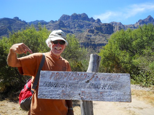
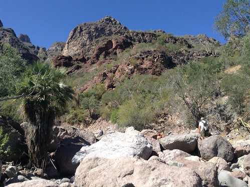
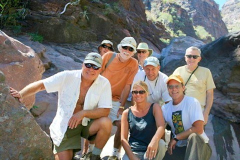
When we arrived at the dirt road that was the start of the hike, we were met with a worn-out Privado sign which was not described in the hiking book. Since there was a group of us, we rationalized that since the sign was not maintained, it was OK to pass the sign and continue up the dirt road. Gary is posing by the sign with the Las Gigantes looming up behind him.
After walking about 15 minutes we passed by a road to the right that crossed the arroyo and led to a rancheria. We continued heading up to the canyon area with fabulous views of the mountains.
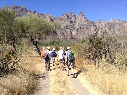
We continued on the road until it began to narrow down. At that point, we saw a rough steep trail that headed to the arroyo about 50 feet below us. Some of us slid on our butts, some grabbed for a green belay and were rewarded with a hand full of stickers-------grabbing limbs may work in the Northwest, but not in the Baja.
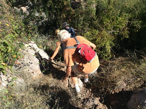
The Juncalito arroyo was well marked with cairns---pyramid piles of rocks--so it was fairly easy to continue up the canyon where we found our first water with much more to follow.
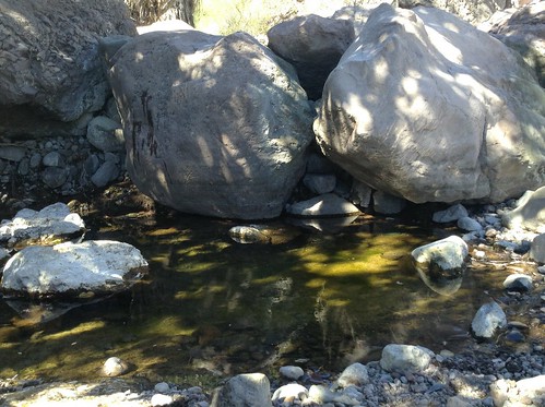
As we continued up over the next two miles we continued to climb up over a series of pools, each one more interesting than the last as well as more difficult to climb.
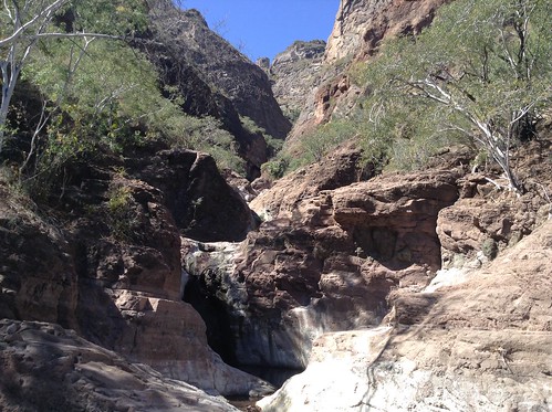
When we first looked ahead, we thought that we were at the end of our hike, but gradually we found places to scramble up and around. We then came to several more beautiful pools with thin waterfalls.
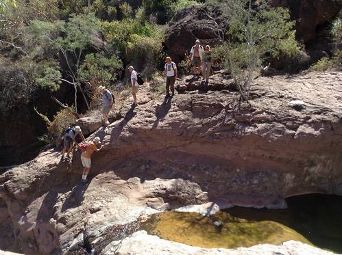
In the photo below, I am standing at the top of one of the last waterfalls we climbed to and John is standing between two of the pools below.
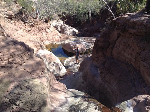
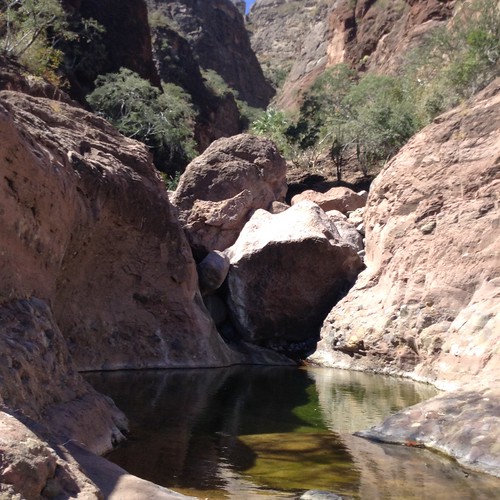
This is the last waterfall we came to before deciding to turn around even though it looks like we could scramble up a scree slope to the right and way up the side of the canyon. This was one of the most dramatic hikes we have taken and is even better than the once-popular Tabor Canyon about another 5 miles south of here. The recent hurricanes and tropical storms did not fill up the pools like what happened to much of Tabor Canyon.

The trip up to the last waterfall and back to the cars was just over 4 miles and took us about 4 hours including the wait for the construction work.
On our way to the car, we heard someone talking near the ranchero close to Highway 1. On the last hike we took near San Javier, we ended up having to pay the rancher 50 pesos apiece to pass through his land. We were hoping this would not be a repeat of that situation. Fortunately, we got to the highway unchallenged.
After we got to the car, our return to Loreto Bay was again delayed by about 45 minutes while the crews pushed more rocks down onto the highway.
Some of us stopped at the clam shack---Vista Del Mar--on the way back for some ice-cold Cerveza and stuffed clams. A delicious way to end a wonderful hike. Too hungry to take a picture of the stuffed clams, but here is another great eating place--a bit fancier than the shore side Clam Shack.
Here are some stuffed clams with a margarita at Picazon and not the Clam Shack, but you get the idea.

Subscribe to my YouTube Channel
I have recently uploaded all of my travel videos to YouTube now that they allow longer uploads. I have also added other shorter travel videos.
That link is https://www.youtube.com/c/huntforgold
If you do go there, please subscribe to my video channel since it will help me eventually get some income there and help with my future travels.
No comments:
Post a Comment