
At Forester Pass, the highest point on the Pacific Crest Trail
Section F Mojave to Walker Pass
On June 15th, I resumed my northbound hike through miles of small and large windmills on the way up to the beginning of the Sierra Mountain Range with the Mojave Desert spread out to the east below.


Although it was a hot climb up, the temperature as I climbed up from 3,823 ft to 6,000 ft. The vegetation changed from Joshua Trees and chaparral to juniper, pine, and oak groves.
I stopped for the night at the Golden Oak Springs. Unfortunately, the well-built spring box fence had been torn down by thirsty cattle so I had to share the water with them and avoid the floaters. I was joined for the night by another thru-hiker named Saltlick who I would continue to meet up with all the way to Vermillion Valley Resort.

It was a 17-mile hike of 14 hours with ascents of 4,039 ft and descents of 3,740 ft., and I carried 4 liters of water.
On June 16th, I continued along the ridgeline of the Piute Mountain Range and reached an elevation of 6,788 ft., and ended up at the Piute Mountain Road.


When I went to get water at a nearby water tank and trough, I shared the trough with a nearby rattlesnake. Its rattling got my attention. I hiked for 16 hours and went 22 miles with ascents of 5,755 ft and descents of 4,557 ft.
On June 17th, the PCT was competing with some of the Off-Road Vehicles (ORV) creating their own trails, using the PCT and the frequent dirt roads—a few leading to mining claims like the St. John’s, Sunset, and Danny Boy Gold Mines.

Although this was a dry stretch, there were forests of the pinyon tree. Apparently, Native Americans harvest the cones and roast them to release the pine nuts for food. I ended the day at McIvers Spring with its nearby 1997 lightning-caused burned cabin.
It was an 18-hour hike that covered 36 miles with ascents of 6,030 ft and descents of 5,590 ft and another 4 water liter day.
On June 18th, it was a short 3-hour 8-mile hike to Walker Pass where I hitch-hiked into Lake Isabella a long 37-mile hike I waited for a hitch for just 10 minutes. After checking into a motel and getting a shower, washing my clothes, I headed out with my bright yellow rain jacket and pants to the nearby cafe where I enjoyed a big lunch. I returned later for another huge dinner.
Section G Walker Pass to Mt. Whitney
On June 19th, after another huge breakfast, I quickly got a hitch back up to Walker Pass on Highway 178. At the beginning of this section of the PCT, there is a memorial marker that describes how the US Board of Geographic Names named the mountain I was traversing, Mt Jenkins after James Jenkins who was one of the authors of the “Pacific Crest Trail” and had long scouted this route for the PCT while also researching the flora, fauna, and history of the southern Sierras.

After a 15 hours 29 mile hike with assents of 5,709 ft and descents of 5,331 ft, I arrived at a campground at the PCT and Canebrake Road intersection.
On June 20th, I was eager to hike down to Kennedy Meadows which is the thru-hikers gateway to the big Sierra Mountains. I passed through the remnants of the Manter Fire which occurred in 2000 and burned about 68,000 acres. It burned along the next 14 miles of the PCT.


I finally got past the fire zone and stopped among these Jeffrey pine trees. A bit later, I came to this vast sage meadow that just before I got to Kennedy Meadows, my resupply place for the night. It was a 10-hour hike of 21 miles with ascents of 4,078 ft and descents of 3,714 ft.


While I camped out here, I was able to wash my clothes, get a food resupply, and gorge out for dinner and breakfast before I headed out. I picked up my bear canister at the General Store since hikers are required to use these while hiking through the upcoming National Parks. You are supposed to put your food in the bear canisters to keep your food safe from the bears.
There were other thru-hikers here as well as “Meadow Ed” Faubert who I had met at previous ALDA-West Gatherings who plied us with hamburgers. Here is a picture of Meadow Ed on the left along with Roger Carpenter during Roger’s 1995 thru-hike. He was one of just 20 who thru-hiked that year.

Both Meadow Ed and Roger had met up with Cheryl Strayed in 1995, who wrote Wild--From Lost to Found on the Pacific Crest Trail in 2013. The Wild movie starring Reece Witherspoon came out in 2014. Both in her book and the movie, the character she meets up with on the trail just before Kennedy Meadows, and he travels with her for a portion of the trail was named Greg, but it was really Roger Carpenter. Here is a link to an article that Roger Carpenter wrote about his experiences with Cheryl Strayed.

When Cheryl Strayed was at a book signing in Portland in 2014, Roger met her there and she said, “Roger, have you come out as Greg yet?” After that Roger had a new trail name: “I am Greg from Wild” or a shorter version was “Greg from Wild”.
Her book contributed greatly to the significant increase in the number of thru-hikers, especially women, completing the PCT from just 276 in 2013 to 665 in 2015, the year after the book and movie releases, to 1,177 in 2018. The number of thru-hike permits issued by the PCTA went from 1,879 in 2013 to 5,657 in 2015 and 7,888 in 2018 with a significant increase in women hikers.
The PCT and other long-distance trails are closed this year because of COVID 19 with the risk to the remote trail communities of hikers who may be contagious. In recent years, the PCTA has begun limiting the number of permits issued per day so hikers aren’t so bunched up and ruining the wilderness experience.
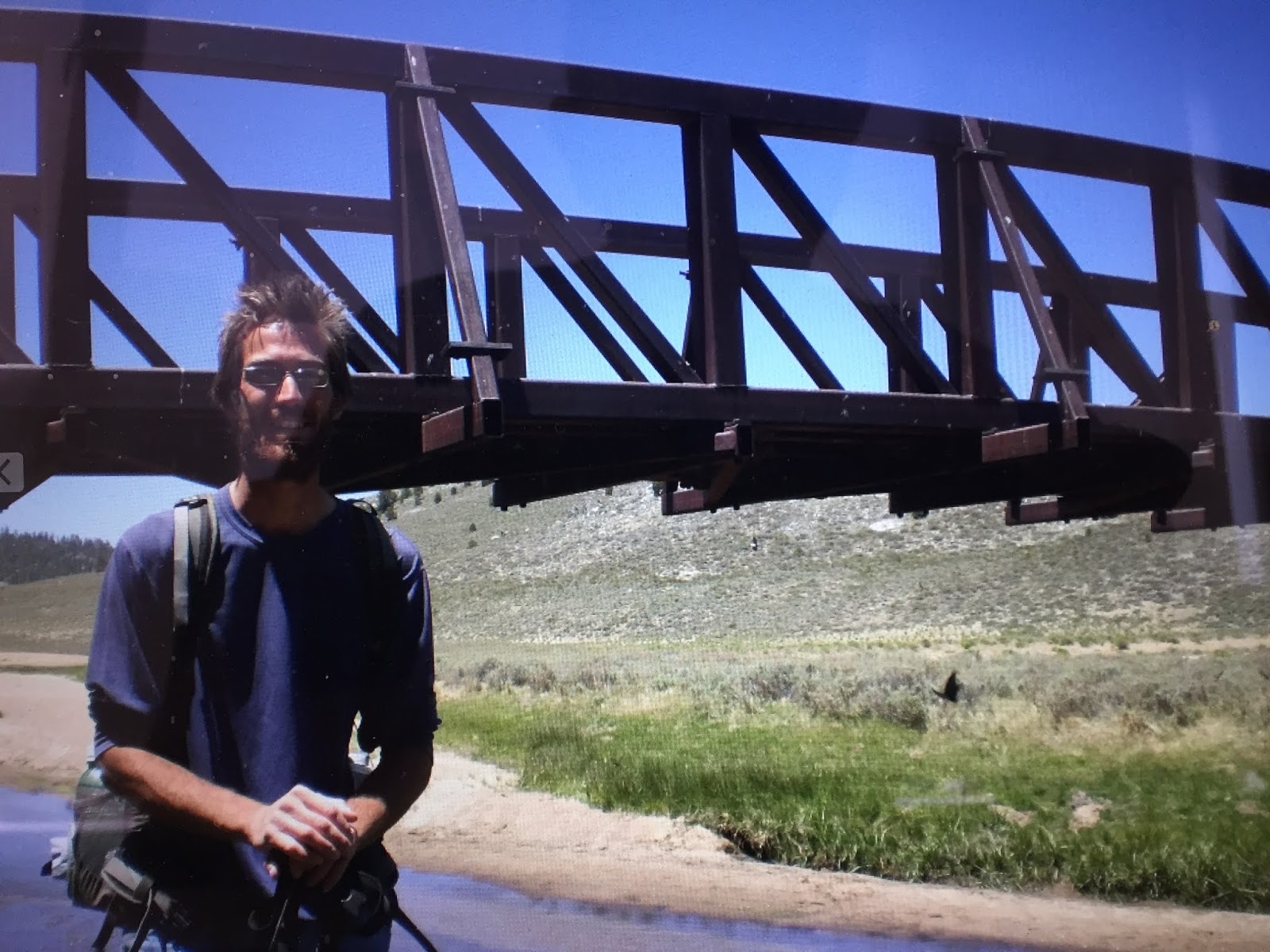
On June 21st, with three more pounds of base pack weight thanks to the mandatory bear canister, I headed out along with Saltlick where we would be hiking over the highest point on the PCT, Forester Pass at an elevation of 13,113 ft. We took a break along the grassy slopes by the Kern River Bridge.

Here is a look back at Kennedy Meadows

We gained about 3,000 ft during the day including river fords, and ups and downs over passes and saddles until we reached Gomez Meadows for the night. It was a 17-hour hike of 29 miles with ascents of 4,682 ft and descents of 2,589 ft.

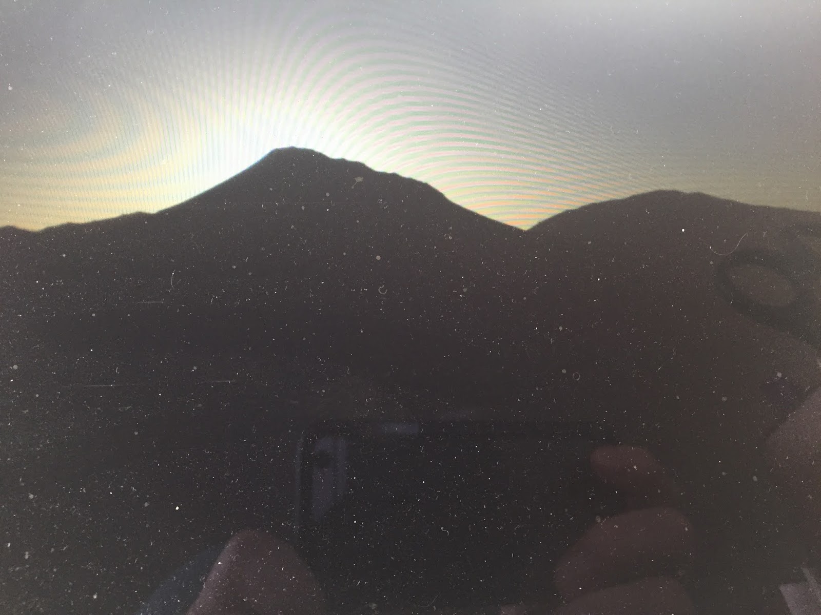
On June 22nd, as we came up to a saddle, we could see the Owens Valley below and the dried up Owens Lake, I remembered that this lake was featured in the movie, Chinatown, which starred Jack Nicholson. The movie dealt with the Water Wars where the LA Water Department dried out the lake so property values would plummet along with other shady land deals. Lots of deception and intrigue along with the ending memorable quote, “Forget it, Jake. It’s Chinatown.”


We ended the day at Chicken Springs Lake at an elevation of 11,300 ft after hiking for 16 hours with ascents of 4,737 ft and descents of 2,360 ft. It was getting colder at night at this elevation with ice forming along the edges of the lake.
On June 23rd, we hiked through some forests of pines and creek crossings, I stopped to wash out my socks and boots at this Rock Creek crossing.


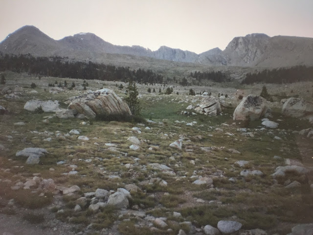
We passed by the distant bare Bighorn Plateau.

Section H Mt. Whitney to Vermillion Valley Resort
We came to the junction of the John Muir Trail (JMT)which goes from Yosemite Valley to Mt. Whitney near Crabtree Meadows. As we continued north on the joint PCT and John Muir Trail we would smell the soapy freshness of the JMT hikers usually wearing their new gear. We also spotted a helicopter ferrying in some Forest Service employees and supplies to the Crabtree Ranger Station.
Most of the day was spent walking above the tree line. We ended the day at the Lake South America trail junction after hiking 17 hours and 25 miles with ascents of 4,393 ft and descents of 4,534 ft.
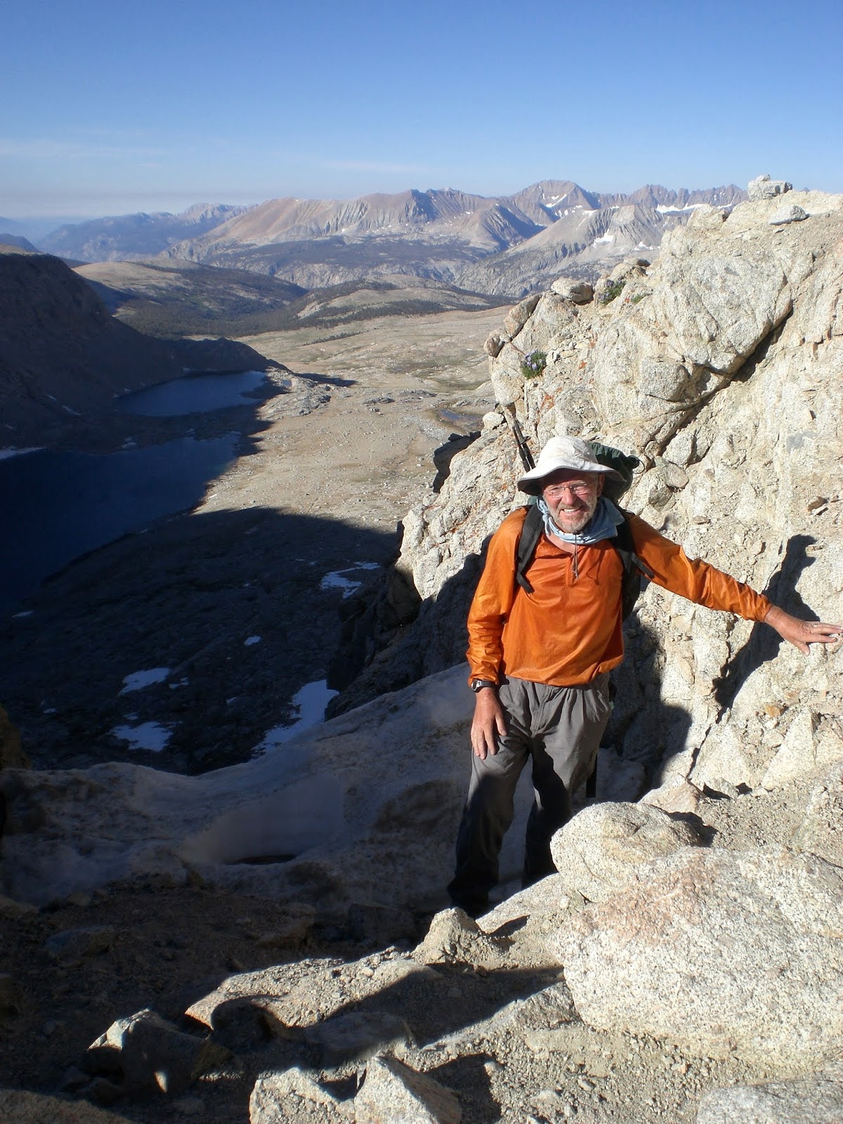
On June 24th, we got up early to climb over Forester Pass, the highest point on the PCT at 13,113 ft. It was a grueling ascent of 3,264 ft in just 1.7 miles from our last camp. Fortunately, almost all of the snow had melted when we crossed over.

Forester Pass is the low notch just above my head in this picture of me all bundled up.


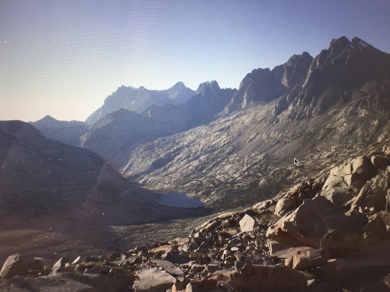
The PCT was clear of snow on the north side of Forester Pass as the trail passed a number of small tarns and Rae Lakes. This was really spectacular scenery as we made our way to Woods Creek for the night.


We hiked for 18 hours of 26 miles with ascents of 5,059 ft and descents of 7,434 ft.
On June 25th, Saltlick decided to explore the Rae Lakes area and possibly climb the Painted Lady peak that looms above Rae Lake.


I continued on over Pinchot and Mather Passes and 1,300 ft down the Golden Staircase to my campsite at Deer Meadow for some 18 hours and 25 miles with ascents of 5,059 ft and descents of 7,434 ft.
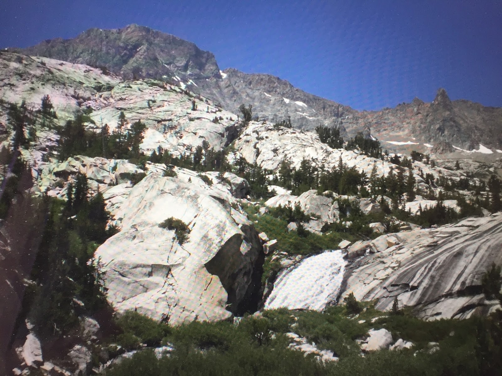
On June 26th, I continued on down Palisade Creek followed by the Middle Fork Kings River until I came to the Evolution Basin full of beautiful deep blue lakes and tarns.


I headed up the trail to Muir Hut built by the Sierra Club that marked Muir Pass.


From there I began hiking through the Evolution Basin past Wanda and Sapphire Lakes.


From there I came to the Evolution Creek ford which would be the deepest ford on the PCT and fortunately the water was running low when I crossed it.
When fording these rivers, I usually take off my socks and cross with my shoes on and my backpack waistband free in case I fall in the water. My trekking poles aided in crossing.

At this point, I decided to keep going through the night until I got to the Vermillion Valley Resort to end this year’s PCT adventure. My feet were in good shape, but after going through this spectacular section I was tired of hiking.
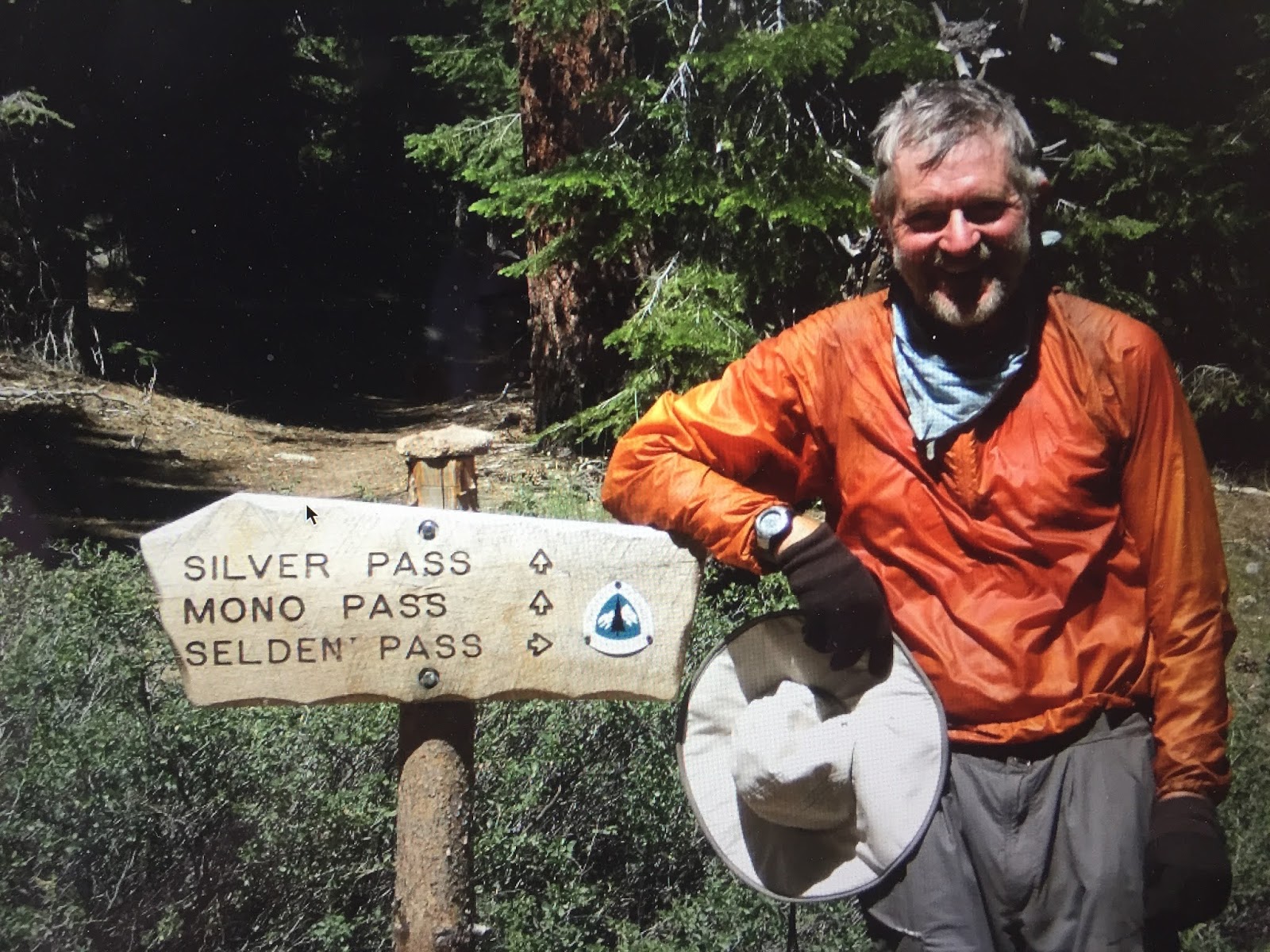
On June 27th, I hiked through the night down the San Joaquin River and then up to Piute Pass. As dawn broke, I was heading to Selden Pass, when I met another northbound hiker named Jackie Harris who was once a student of my brother, Jim, at Whitworth University in Spokane. Jackie had taken a history class from my brother. We hiked together up to Selden Pass.


We then continued to Marie Lake and then down to the trail junction that would take me to the Vermillion Valley Resort. Jackie continued on to Red Meadows.

That was a very, very long day for me since I had hiked 57 miles in 28 hours. Fortunately, the resort was running a boat service to their resort on Lake Edison which saved me a 5-mile hike.
The resort was great. They had tents with several beds in each of the tents for hikers, fishermen, and hunters. It was grilled steak night with baked potatoes, and vegetables along with cold beer. Just what I needed.
I was now wondering how I would get back home and thought for a while I might need to get back on the trail and hike to Mammoth Lakes some 29 trail miles away from where there was regular bus service to Fresno. From Fresno, I learned that travel by air was cheaper than by AMTRAK which I would have preferred.
The Vermilion Valley Resort was at the end of a long dirt road before it got to a highway and then on to Fresno where I would I lucked out though because while sitting around the campfire I met Vince Nguyen, the Edison Dam Chief Engineer who worked there 3 days a week and then went back home to the LA area. He was heading home the following morning and gave me a ride to the Fresno Airport.
Once at the airport, I got an Alaska Air flight back to Seattle with a short stop in Sacramento within 3 hours of arrival.


For this 2007 PCT hike, I traveled about 800 miles in 37 days for an average of 22 miles per day.
My next blog entry In 2008, will cover the remaining parts of the PCT in California and Oregon. I returned to Fresno and hitchhiked back up to Vermillion Valley Resort and resumed my PCT adventure up north to Dunsmuir, CA. I then took the AMTRAK Coast Starlight to Eugene and hitchhiked up to McKenzie Pass, Highway 242 where I hiked the last portion from McKenzie Pass to the Bridge of the Gods at the Columbia River. This portion was closed for me back in 2006 because of a fire.
Subscribe to My YouTube Channel
I have recently uploaded all of my travel videos to YouTube now that they allow longer uploads and you may want to see my travel adventures there. That link is
https://www.youtube.com/c/huntforgold.
If you do go there, please subscribe to my video channel since it will help me eventually get some income there and help with my future travels.
No comments:
Post a Comment